
Course Overview
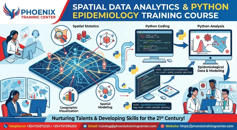
This comprehensive program equips epidemioloGISts, public health analysts, spatial data scientists, and biostatisticians with core skills in spatial data processing and epidemiological modeling. As global public health challenges grow increasingly complex, leverage of computational programming becomes essential for tracking disease transmission, analyzing health disparities, and optimizing resource allocation. Participants will master core concepts in spatial data handling, geospatial vector/raster analysis, disease surveillance modeling, and automated health mapping workflows.
Designed as an intensive Python for GIS course, the curriculum bridges geospatial analysis and public health research. Key topics include spatial point pattern analysis, outbreak cluster detection, contact tracing algorithms, compartment modeling (SIR/SEIR), and satellite remote sensing for vector-borne disease tracking. Through practical exercises using modern Python epidemiology tools and Python libraries, attendees will learn how to build reproducible workflows to support evidence-based public health policy.
Upon the successful completion of this Spatial Data Analytics and Python Epidemiology Training Course, participants will be able to:
ü Apply Python for GIS course tools to manipulate, analyze, and visualize complex spatial health datasets.
ü Perform spatial point pattern analysis and cluster detection for disease outbreak investigations using Python epidemiology methodologies.
ü Construct compartment and transmission models using Python scripts to simulate disease dynamics and intervention strategies.
ü Integrate satellite remote sensing and environmental raster data to map disease risk factors.
ü Develop automated public health dashboards and reproducible spatial workflows using open-source Python libraries.
Training Methodology
The training methodology is highly interactive, practical, and participant-centered, combining structured lectures with hands-on exercises. The course is designed to be highly interactive, challenging and stimulating. It will be an instructor led training and will be delivered using a blended learning approach comprising of:
ü Interactive lectures exploring spatial statistics, GIS concepts, and mathematical epidemiology theories
ü Hands-on laboratory sessions utilizing Python programming environments (Jupyter Notebooks, Google Colab)
ü Real-world public health case studies evaluating outbreak data, disease mapping, and intervention strategies
ü Group practical exercises focusing on building custom Python epidemiology pipelines and interactive spatial dashboards
ü Guided problem-solving workshops applying Python for GIS course techniques to real-world disease surveillance datasets
Our facilitators are seasoned industry professionals with years of expertise in their chosen fields. All facilitation and course materials will be offered in English.
Who Should Attend?
This Spatial Data Analytics and Python Epidemiology Training Course would be suitable for, but not limited to:
ü EpidemioloGISts and Public Health Analysts
ü GIS Specialists and Spatial Data Scientists
ü Biostatisticians and Data Analysts in Health Research
ü Disease Surveillance Officers and Health Program Managers
ü Healthcare Researchers and Academic Scholars
ü Environmental Health Officers
Benefits of the Training
Personal Benefits
ü Develop advanced computational competencies in spatial data analytics and programming.
ü Master cutting-edge tools through a dedicated Python for GIS course framework focused on public health solutions.
ü Acquire specialized skills in Python epidemiology to model disease dynamics and forecast outbreak trends.
ü Elevate professional standing as a versatile data scientist capable of handling complex public health workflows.
Organizational Benefits
ü Improve institutional response times during public health emergencies through automated data processing.
ü Strengthen disease surveillance systems by incorporating spatial cluster analysis and predictive modeling.
ü Reduce operational costs by deploying open-source Python solutions for spatial and statistical analysis.
ü Enhance evidence-based decision-making with high-precision health maps and interactive surveillance dashboards.
ü Course Duration: 5 Days
ü Training Fee
o Physical Training: USD 1,500
o Online / Virtual Training: USD 1,000
Module 1: Foundations of Python Programming for Public Health and GIS
ü Introduction to fundamental data structures, control flow, and functions in Python
ü Data manipulation and cleaning using Pandas and NumPy for health surveillance datasets
ü Working with time-series health data, incident reporting, and demographic records
ü Visualizing epidemiological trends using Matplotlib and Seaborn libraries
ü Practical Session: Building an automated script in a Python for GIS course setting to clean, reshape, and analyze national disease surveillance datasets
Module 2: Geospatial Vector Data Handling and Spatial Operations
ü Working with spatial vector data structures (Shapefiles, GeoJSON, Geopackages) using GeoPandas
ü Coordinate Reference Systems (CRS), map projections, and reprojection techniques
ü Spatial joins, buffering, overlay operations, and polygon intersections for health catchment areas
ü Geocoding health facility addresses and patient location data securely
ü Practical Session: Executing spatial joins between patient incident locations and administrative boundary shapefiles using Python
Module 3: Raster Data Processing and Environmental Risk Mapping
ü Core concepts of raster data processing using Rasterio and Xarray
ü Extracting elevation, temperature, and precipitation values for health exposure analysis
ü Raster reclassification, map algebra, and environmental risk indexing
ü Zonal statistics computation for health administrative regions
ü Practical Session: Processing satellite temperature and rainfall rasters to map environmental suitability for malaria transmission
Module 4: Spatial Point Pattern Analysis and Disease Cluster Detection
ü Principles of point pattern analysis in disease outbreak investigations
ü Quadrat analysis, Ripley’s K-function, and Kernel Density Estimation (KDE) for disease mapping
ü Identifying spatial hotspots using DBSCAN and HDBSCAN clustering algorithms
ü Detecting spatial and spatio-temporal disease clusters using Kulldorff Scan Statistics
ü Practical Session: Applying Kernel Density Estimation in a Python epidemiology environment to map cholera outbreak hotspots
Module 5: Exploratory Spatial Data Analysis (ESDA) and Health Autocorrelation
ü Understanding spatial autocorrelation and Tobler’s First Law of Geography
ü Global spatial autocorrelation measurement using Global Moran’s I and Geary’s C
ü Identifying local spatial clusters and outliers using Local Indicators of Spatial Association (LISA)
ü Spatial weight matrix construction (Contiguity, K-Nearest Neighbors, Distance Band)
ü Practical Session: Computing Local Moran's I to identify high-high and low-low health outcome clusters across regional districts
Module 6: Mathematical Epidemiology and Infectious Disease Modeling
ü Fundamentals of deterministic compartment models (SIR, SEIR, SIS)
ü Implementing differential equations using SciPy for epidemic curve modeling
ü Estimating basic reproduction numbers ($R_0$) and effective reproduction numbers ($R_t$)
ü Simulating non-pharmaceutical interventions (vaccination, quarantine, social distancing)
ü Practical Session: Building a customized SEIR model in Python epidemiology to project disease transmission trajectories under intervention scenarios
Module 7: Spatial Regression and Geographically Weighted Regression (GWR)
ü Limitations of Ordinary Least Squares (OLS) regression for spatial health data
ü Implementing Spatial Lag and Spatial Error regression models using PySAL
ü Geographically Weighted Regression (GWR) for modeling spatially varying relationships
ü Assessing model diagnostics, Akaike Information Criterion (AIC), and residual spatial dependence
ü Practical Session: Running a Geographically Weighted Regression to evaluate variable relationships between socio-economic factors and respiratory illness rates
Module 8: Satellite Remote Sensing and Vector-Borne Disease Surveillance
ü Accessing and processing Earth observation data (Sentinel, MODIS, Landsat)
ü Calculating environmental indices: Normalized Difference Vegetation Index (NDVI) and Normalized Difference Water Index (NDWI)
ü Integrating climate covariate time-series with vector-borne disease incidence data
ü Predicting seasonal vector habitat suitability using machine learning classifiers
ü Practical Session: Extracting multi-temporal NDVI data via Python scripts to model seasonal dengue fever outbreak risks
Module 9: Automated Spatial Workflows and Health Data Pipelines
ü Designing reproducible end-to-end data processing pipelines for public health reporting
ü Automating repetitive GIS tasks using ArcPy and QGIS Python API (PyQGIS)
ü Integrating spatial data validation, error handling, and automated logging
ü Scheduled batch processing of daily disease notification data
ü Practical Session: Automating a multi-step GIS workflow in a Python for GIS course environment to generate daily disease risk maps
Module 10: Interactive Health Mapping, Dashboards, and Web GIS
ü Creating interactive web maps using Folium, Leaflet, and Plotly Express
ü Building public health surveillance web dashboards using Streamlit or Dash
ü Publishing spatial layers to Web Feature Services (WFS) and Web Map Services (WMS)
ü Communicating spatial risk, health equity metrics, and uncertainty effectively to policy makers
ü Practical Session: Deploying an interactive real-time public health dashboard featuring spatial maps, time-series charts, and epidemiological metric summaries
About Our Trainers
Our training facilitators are recognized experts in spatial data science, public health informatics, and computational epidemiology, holding advanced academic degrees (PhD/MSc) in Epidemiology, GIS, and Biostatistics. With over 15 years of combined field experience, they have led spatial surveillance initiatives for international health agencies, governmental bodies, and academic research institutions. Their practical expertise ensures a hands-on learning experience that bridges theoretical spatial modeling with real-world public health application.
Quality Statement
Phoenix Center for Policy, Research and Training is dedicated to delivering high-impact, practical, and globally benchmarked learning solutions. We adhere to rigorous quality assurance standards across all program phases—from curriculum design and facilitator selection to workshop execution and post-training evaluation. Our continuous feedback mechanisms guarantee that our training offerings remain innovative, relevant, and directly aligned with modern industry needs.
Tailor-Made Courses
We understand that every organization has unique challenges and opportunities as well as unique training needs. Phoenix Training Center offers tailor-made courses designed to address specific requirements and challenges faced by your team or organization. Whether you need a customized curriculum, a specific duration, or on-site delivery, we can adapt our expertise to provide a training solution that perfectly aligns with your objectives. We can customize this Course to focus on your industry, specific risk profile, or internal stakeholder dynamics. Contact us to discuss how we can create a bespoke training program that maximizes value and impact for your team. For further inquiries, please contact us on Tel: +254720272325 / +254737296202 or Email training@phoenixtrainingcenter.com.
Admission Criteria
ü Participants should be reasonably proficient in English.
ü Applicants must live up to Phoenix Center for Policy, Research and Training admission criteria.
Terms and Conditions
ü Discounts: Organizations sponsoring Four Participants will have the 5th attend Free
ü What is catered for by the Course Fees: Fees cater for all requirements for the training – Learning materials, Lunches, Teas, Snacks and Certification. All participants will additionally cater for their travel and accommodation expenses, visa application, insurance, and other personal expenses.
ü Certificate Awarded: Participants are awarded Certificates of Participation at the end of the training.
ü Course Improvement: The program content shown here is for guidance purposes only. Our continuous course improvement process may lead to changes in topics and course structure.
ü Approval of Course: Our Programs are NITA Approved. Participating organizations can therefore claim reimbursement on fees paid in accordance with NITA Rules.
Booking for Training
Kindly send an email to the Training Officer on training@phoenixtrainingcenter.com and we will send you a registration form. We advise you to book early to avoid missing a seat to this training. Or call us on +254720272325 / +254737296202
Payment Options
We provide 3 payment options, choose one for your convenience, and kindly make payments a week before the training starts (at least 5 to 7 days before the Training start date) to reserve your seat:
ü Groups of 5 People and Above – Cheque Payments to: Phoenix Center for Policy, Research and Training Limited should be paid in advance, a week before the training starts.
ü Invoice: We can send a bill directly to you or your company.
ü Deposit directly into Bank Account (Account details provided upon request)
Cancellation Policy
ü Payment for all courses includes a registration fee, which is non-refundable, and equals 15% of the total sum of the course fee.
ü Participants may cancel attendance 14 days or more prior to the training commencement date.
ü No refunds will be made 14 days or less before the training commencement date. However, participants who are unable to attend may opt to attend a similar training course at a later date or send a substitute participant provided the participation criteria have been met.
Accommodation and Airport Pick-up
For physical training attendees, we can assist with recommendations for accommodation near the training venue. Airport pick-up services can also be arranged upon request to ensure a smooth arrival. Please inform us of your travel details in advance if you require these services. For reservations contact the Training Officer on Email: training@phoenixtrainingcenter.com or on Tel: +254720272325 / +254737296202.
| Course Dates | Venue | Fees | Enroll |
|---|

Phoenix Training Center
Typically replies in minutes