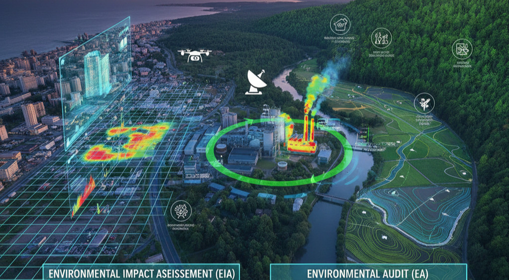
This comprehensive training course is designed to provide environmental professionals with the essential skills and knowledge to effectively apply Geographic Information Systems (GIS) and Remote Sensing in Environmental Impact Assessments (EIA) and Environmental Audits (EA). In today's data-driven world, these powerful tools are essential for analyzing spatial data, visualizing complex environmental information, and making informed decisions. This program offers a structured framework for using GIS and remote sensing to streamline data collection, enhance impact prediction, and create compelling, defensible reports.
The curriculum is structured to provide a logical and practical pathway to expertise in these technologies. We begin with the foundational concepts of both GIS and remote sensing before diving into their practical applications across various environmental domains, including air, water, soil, biodiversity, and socioeconomic factors. The training then progresses to advanced topics like spatial analysis, modeling, and cumulative impact assessment. The course places a strong emphasis on hands-on exercises and real-world case studies to ensure that participants gain practical skills they can immediately apply in their professional work.
Who should attend the training
- Environmental practitioners
- EIA/EA experts
- Project managers
- Regulatory officials
- GIS analysts
- Researchers and academics
Objectives of the training
- To understand the foundational principles of GIS and remote sensing.
- To master the practical application of these tools in environmental assessments.
- To learn how to acquire, process, and analyze spatial environmental data.
- To develop effective maps and visualizations for EIA and EA reports.
- To master the skills required for GIS-based modeling and analysis.
Personal benefits
- Gain specialized, in-demand technical skills for a rapidly growing field.
- Enhance your ability to visualize and interpret complex environmental data.
- Improve your efficiency in data collection, analysis, and reporting.
- Strengthen your professional credibility and marketability in the industry.
- Learn to communicate environmental findings more effectively through visual media.
Organizational benefits
- Streamline data management and analysis processes, reducing project timelines and costs.
- Improve the accuracy and defensibility of environmental reports.
- Proactively manage project risks through enhanced spatial analysis.
- Enhance corporate reputation through cutting-edge and transparent reporting.
- Align project development with global standards and best practices in technology application.
Training methodology
- Interactive lectures and presentations
- Group discussions and brainstorming sessions
- Case studies and real-world examples
- Hands-on software tutorials using open-source tools
- Individual and group practical exercises
- Feedback and Q&A sessions
Trainer Experience Our trainers are seasoned professionals with extensive experience in applying GIS and remote sensing to environmental projects. They have a strong academic background and practical experience in spatial analysis and data visualization across various sectors. Their hands-on expertise ensures that the training is not only informative but also highly relevant and applicable to real-world scenarios.
Quality statement We are dedicated to providing high-quality, impactful training that adheres to the highest professional standards. Our courses are continually reviewed and updated to incorporate the latest developments and best practices in the fields of GIS, remote sensing, and environmental assessment.
Tailor-made courses We offer customized training solutions tailored to the specific needs of your organization. We can design a program with a focus on a particular industry, a specific country's regulations, or a combination of topics to meet your unique requirements.
Course Duration: 10 days
Training fee: USD 2500
Module 1: Introduction to GIS and Remote Sensing in EIA and EA
- The fundamental concepts of GIS and remote sensing.
- The historical evolution and a brief overview of the tools.
- The specific benefits of using GIS and RS in environmental assessments.
- The typical workflow for a GIS-based EIA.
- The integration of spatial data with non-spatial data.
- Practical session: A group discussion on the applications of GIS and RS in your specific work context.
Module 2: Foundational Concepts of GIS
- What is GIS? Components and functions of a GIS.
- Understanding spatial data: vector and raster data models.
- Coordinate systems and map projections.
- Essential GIS operations: georeferencing, clipping, and merging.
- Data sources for environmental GIS projects.
- Practical session: A hands-on exercise on basic GIS data manipulation.
Module 3: Practical GIS for Environmental Baselines
- How to acquire, clean, and organize baseline data.
- Creating and editing spatial data layers (points, lines, polygons).
- Importing data from different sources (GPS, databases, spreadsheets).
- Mapping sensitive receptors and project-related features.
- The use of GIS for site selection and feasibility studies.
- Practical session: A hands-on exercise to create a baseline map for a project site.
Module 4: Foundational Concepts of Remote Sensing
- What is remote sensing? The electromagnetic spectrum and its relevance.
- An overview of common satellite and aerial imagery.
- Understanding different image types (e.g., true color, false color composites).
- The concept of spatial, spectral, temporal, and radiometric resolution.
- The basics of image interpretation and classification.
- Practical session: A hands-on exercise on interpreting satellite imagery for land cover types.
Module 5: Practical Remote Sensing for Environmental Mapping
- The process of acquiring and processing satellite imagery.
- Techniques for land cover classification and change detection.
- The use of remote sensing for habitat mapping and vegetation assessment.
- Applications in monitoring land degradation and deforestation.
- The role of drones and aerial photography in remote sensing.
- Practical session: A hands-on exercise to map land cover changes in a specific area.
Module 6: GIS for Air Quality Assessment
- The use of GIS to map air pollution sources and receptors.
- Visualizing pollutant dispersion models.
- The integration of air quality monitoring data into a GIS.
- Using GIS to identify sensitive populations at risk from air pollution.
- The role of GIS in developing air quality management plans.
- Practical session: A hands-on exercise to create a map showing pollutant concentration gradients.
Module 7: GIS for Water Resources Assessment
- Using GIS to delineate watersheds and drainage networks.
- Mapping water quality data and creating contamination plumes.
- The use of GIS for flood risk assessment and modeling.
- The identification of groundwater recharge areas and contamination risks.
- The role of GIS in managing water resources and assessing impacts on aquatic ecosystems.
- Practical session: A hands-on exercise on mapping a watershed and identifying potential pollution sources.
Module 8: GIS for Soil and Land Use Planning
- Using GIS to map soil types, erosion, and contamination.
- The creation of land capability and suitability maps.
- The use of GIS to track land use changes over time.
- The integration of soil data with project infrastructure layers.
- The role of GIS in land remediation and rehabilitation planning.
- Practical session: A hands-on exercise to create a map for optimal land use.
Module 9: GIS for Noise and Visual Impact Assessment
- The use of GIS to create noise contours and models.
- Mapping noise sources and sensitive receptors.
- The use of GIS to create visual simulations and viewshed analysis.
- The integration of visual impact data with project design.
- The role of GIS in mitigating noise and visual impacts.
- Practical session: A hands-on exercise to perform a viewshed analysis for a project.
Module 10: GIS for Biodiversity Assessment
- Using GIS to map and analyze species habitats and distribution.
- The identification of critical habitats and ecological corridors.
- The use of GIS in creating biodiversity management plans.
- The role of remote sensing in monitoring habitat changes.
- The integration of biodiversity data with project footprint.
- Practical session: A hands-on exercise on creating a biodiversity hotspot map.
Module 11: GIS for Socioeconomic Impact Assessment (SIA)
- The use of GIS for demographic and community profiling.
- Mapping social receptors, infrastructure, and cultural sites.
- The use of GIS to visualize and analyze public participation data.
- The role of GIS in assessing impacts on livelihoods and cultural heritage.
- The integration of socioeconomic data with environmental impact layers.
- Practical session: A hands-on exercise to map social and cultural features in a project area.
Module 12: Data Collection and Field Integration
- The use of Global Positioning Systems (GPS) for data collection.
- The use of mobile GIS apps for field surveys.
- Data synchronization between field and office.
- Ensuring data quality and accuracy during fieldwork.
- The integration of drone data into a GIS.
- Practical session: A hands-on exercise on using a mobile app for field data collection.
Module 13: Spatial Analysis and Modeling
- Performing spatial queries and overlay analysis.
- The use of buffer, intersect, and union tools.
- The basics of geostatistical analysis (e.g., kriging).
- The use of GIS for risk assessment and sensitivity mapping.
- The role of modeling in predicting complex environmental changes.
- Practical session: A hands-on exercise to perform a multi-criteria site suitability analysis.
Module 14: GIS for Cumulative Impact Assessment
- The use of GIS to identify past, present, and future projects.
- The creation of a regional project database.
- The use of GIS to overlay project footprints and impact zones.
- The role of GIS in visualizing and communicating cumulative effects.
- A review of methodologies for cumulative impact assessment.
- Practical session: A group exercise to identify and map cumulative impacts in a regional context.
Module 15: GIS for Mitigation and Monitoring
- The use of GIS to design and locate mitigation measures.
- The creation of a GIS-based environmental management system (EMS).
- The use of GIS for tracking and monitoring environmental parameters.
- The role of GIS in adaptive management.
- The use of GIS for incident and non-compliance reporting.
- Practical session: A hands-on exercise to design a monitoring program using GIS.
Module 16: GIS-based Reporting and Communication
- The importance of clear and effective map design.
- The use of GIS for creating infographics and dashboards.
- The development of interactive maps and web GIS applications.
- The role of GIS in communicating with stakeholders.
- The legal and ethical implications of spatial data representation.
- Practical session: A hands-on exercise to create an effective map for a report.
Module 17: Advanced Topics and Emerging Technologies
- An introduction to machine learning in GIS and remote sensing.
- The use of satellite imagery for disaster management.
- An overview of LiDAR and other advanced remote sensing technologies.
- The role of GIS in climate change modeling and risk assessment.
- The integration of GIS with Building Information Modeling (BIM).
- Practical session: A short demonstration of a machine learning application in GIS.
Module 18: Case Studies and Integrated Project
- A review of a successful EIA that heavily utilized GIS and remote sensing.
- A review of a project that faced challenges and how GIS could have helped.
- The future of GIS and remote sensing in the environmental field.
- A final integrated project where participants apply all the learned skills.
- The role of GIS in a career in environmental management.
- Practical session: A final group presentation of an integrated project.
Requirements:
· Participants should be reasonably proficient in English.
· Applicants must live up to Phoenix Training Center admission criteria.
Terms and Conditions
1. Discounts: Organizations sponsoring Four Participants will have the 5th attend Free
2. What is catered for by the Course Fees: Fees cater for all requirements for the training – Learning materials, Lunches, Teas, Snacks and Certification. All participants will additionally cater for their travel and accommodation expenses, visa application, insurance, and other personal expenses.
3. Certificate Awarded: Participants are awarded Certificates of Participation at the end of the training.
4. The program content shown here is for guidance purposes only. Our continuous course improvement process may lead to changes in topics and course structure.
5. Approval of Course: Our Programs are NITA Approved. Participating organizations can therefore claim reimbursement on fees paid in accordance with NITA Rules.
Booking for Training
Simply send an email to the Training Officer on training@phoenixtrainingcenter.com and we will send you a registration form. We advise you to book early to avoid missing a seat to this training.
Or call us on +254720272325 / +254725012095 / +254724452588
Payment Options
We provide 3 payment options, choose one for your convenience, and kindly make payments at least 5 days before the Training start date to reserve your seat:
1. Groups of 5 People and Above – Cheque Payments to: Armstrong Global Training & Development Center Limited should be paid in advance, 5 days to the training.
2. Invoice: We can send a bill directly to you or your company.
3. Deposit directly into Bank Account (Account details provided upon request)
Cancellation Policy
1. Payment for all courses includes a registration fee, which is non-refundable, and equals 15% of the total sum of the course fee.
2. Participants may cancel attendance 14 days or more prior to the training commencement date.
3. No refunds will be made 14 days or less before the training commencement date. However, participants who are unable to attend may opt to attend a similar training course at a later date or send a substitute participant provided the participation criteria have been met.
Tailor Made Courses
This training course can also be customized for your institution upon request for a minimum of 5 participants. You can have it conducted at our Training Centre or at a convenient location. For further inquiries, please contact us on Tel: +254720272325 / +254725012095 / +254724452588 or Email training@phoenixtrainingcenter.com
Accommodation and Airport Transfer
Accommodation and Airport Transfer is arranged upon request and at extra cost. For reservations contact the Training Officer on Email: training@phoenixtrainingcenter.com or on Tel: +254720272325 / +254725012095 / +254724452588