
Course Overview
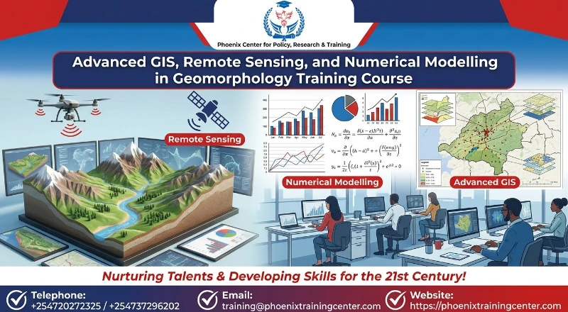
This intensive 5-day course explores how technological advancement—specifically GIS, remote sensing, satellite imagery, and numerical modelling—has transformed geomorphological studies over the last 25 years. Designed for geoscientists, environmental spatial analysts, civil engineers, and hydrologists, the program delivers hands-on technical training to address spatial landscape analysis and geomorphological hazard management. Participants will explore how digital elevation models (DEMs), multi-spectral satellite sensors, LiDAR, and quantitative computer simulations have shifted terrain analysis from qualitative observation to high-precision predictive science.
Throughout the course, participants will investigate the foundational question: How has technological advancement including GIS, remote sensing, satellite imagery, and numerical modelling transformed geomorphological studies in the last 25 years? The modules guide attendees through spatial data acquisition, surface process analysis, coastal and fluvial modeling, land degradation mapping, and landslide susceptibility assessment. By bridging theory with practical software applications, this training equips professionals to utilize modern geospatial technologies to model landscape evolution, evaluate environmental impacts, and support sustainable infrastructure development.
Upon the successful completion of this Advanced GIS, Remote Sensing, and Numerical Modelling in Geomorphology Training Course, participants will be able to:
ü Explain how numerical modelling transformed geomorphological studies, technological advancement, GIS, remote sensing, satellite imagery, and high-resolution spatial data over the last quarter-century.
ü Process high-resolution DEMs, LiDAR datasets, and satellite imagery to extract quantitative terrain parameters and surface drainage networks.
ü Apply advanced GIS spatial analysis tools to monitor coastal, fluvial, and slope processes dynamically over time.
ü Construct and calibrate numerical landscape evolution models to simulate erosion, sediment transport, and landform development.
ü Integrate multi-criteria decision evaluation (MCE) and machine learning models within GIS to map natural hazards and land degradation risks.
Training Methodology
The course is designed to be highly interactive, challenging and stimulating. It will be an instructor led training and will be delivered using a blended learning approach comprising of:
ü Interactive expert presentations showcasing modern spatial workflows and theoretical foundations
ü Guided computer laboratory practicals utilizing open-source and commercial GIS, remote sensing, and numerical modelling platforms
ü Real-world case study evaluations focusing on fluvial dynamics, slope instability, and coastal retreat
ü Small group problem-solving workshops for spatial dataset integration and model parameter calibration
Our facilitators are seasoned industry professionals with years of expertise in their chosen fields. All facilitation and course materials will be offered in English.
Who Should Attend?
This Advanced GIS, Remote Sensing, and Numerical Modelling in Geomorphology Training Course would be suitable for, but not limited to:
ü Geomorphologists and Physical Geographers
ü GIS Specialists and Remote Sensing Analysts
ü Environmental Consultants and Earth Scientists
ü Civil, Geotechnical, and Mining Engineers
ü Hydrologists and Water Resource Managers
ü Disaster Risk Management Officers and Spatial Planners
Benefits of the Training
Personal Benefits
ü Master cutting-edge geospatial software tools and numerical modeling frameworks for high-impact research and industry application.
ü Elevate professional credibility by adopting modern quantitative methods for earth surface process analysis.
ü Expand career opportunities across environmental consulting, academic research, and engineering sectors.
Organizational Benefits
ü Upgrade internal spatial analysis capabilities to conduct precise geomorphological risk and impact assessments.
ü Reduce project costs by using satellite imagery and computational models prior to intensive field campaigns.
ü Improve planning decision-making with high-resolution predictive terrain models and risk mapping tools.
ü Course Duration: 5 Days
ü Training Fee:
o Physical Training: USD 1,500
o Online / Virtual Training: USD 1,000
Module 1: Evolution of Geospatial Technologies in Geomorphology
ü Overview: GIS, remote sensing, satellite imagery, and numerical modelling
ü The shift from qualitative field observations to quantitative digital terrain analysis
ü Principles of Earth Observation (EO) sensors and spatial data architectures in modern geomorphology
ü Integrating multi-source spatial data within GIS platforms
ü Practical Session: Comparative analysis of 1990s vs. modern high-resolution satellite imagery for detecting multi-decadal landform changes.
Module 2: High-Resolution Elevation Data Acquisition and DEM Processing
ü Digital Elevation Models (DEMs), Digital Surface Models (DSMs), and Digital Terrain Models (DTMs)
ü Airborne and terrestrial LiDAR data processing for fine-scale terrain reconstruction
ü Structure-from-Motion (SfM) photogrammetry using Unmanned Aerial Vehicles (UAVs)
ü Hydrological conditioning and error correction in high-resolution elevation grids
ü Practical Session: Filtering raw point cloud LiDAR data and generating a seamless high-resolution DTM using specialized GIS tools.
Module 3: Satellite Imagery Analysis for Surface Feature Extraction
ü Optical, thermal, and Synthetic Aperture Radar (SAR) satellite imagery applications
ü Multi-spectral indices for landcover, vegetation, and surface material differentiation
ü Radar interferometry (InSAR) for monitoring ground deformation and subsidence
ü Time-series satellite imagery processing for dynamic surface change detection
ü Practical Session: Processing Sentinel-1 SAR imagery to detect fine-scale ground displacement across an active fault zone.
Module 4: Quantitative GIS Techniques in Morphometric Analysis
ü Extraction of primary and secondary topographic attributes (slope, aspect, curvature, TWI)
ü Automated drainage network extraction and watershed delineation from DEMs
ü Hypsometric analysis, stream length-gradient indices, and tectonic geomorphology metrics
ü Spatial interpolation methods for geomorphological surface reconstruction
ü Practical Session: Computing morphometric indices and auto-delineating river sub-basins within a GIS environment.
Module 5: Fluvial Geomorphology and Hydro-Morphological Modelling
ü Remote sensing of river channel geometry, planform dynamics, and bar movement
ü 1D and 2D hydraulic numerical modelling for channel flow and sediment transport
ü Assessing river channel migration and bank erosion using historical satellite imagery
ü Hydro-geomorphological flood risk mapping using integrated GIS and hydraulic models
ü Practical Session: Setting up a 2D numerical hydrodynamic model to simulate sediment erosion and deposition along a river reach.
Module 6: Slope Processes, Mass Wasting, and Landslide Modelling
ü Identifying and mapping slope failures using satellite imagery and high-resolution DEMs
ü Geotechnical parameters and spatial triggers for slope instability
ü Heuristic, statistical, and machine-learning approaches to landslide susceptibility mapping
ü 3D numerical runout modelling for debris flows and rockfalls
ü Practical Session: Building a GIS-based statistical landslide susceptibility model using spatial environmental predictors.
Module 7: Coastal Geomorphology, Bathymetry, and Shoreline Dynamics
ü Monitoring shoreline migration using multi-temporal satellite imagery
ü Satellite-Derived Bathymetry (SDB) and coastal elevation models
ü Coastal erosion and accretion rate calculations using automated GIS toolkits
ü Numerical modelling of wave action, longshore sediment transport, and coastal response
ü Practical Session: Calculating historic shoreline erosion rates using the Digital Shoreline Analysis System (DSAS) extension.
Module 8: Arid Lands, Soil Erosion, and Land Degradation Assessment
ü Mapping aeolian landforms and sand dune dynamics using satellite imagery
ü Estimating soil erosion risk using the Revised Universal Soil Loss Equation (RUSLE) in GIS
ü Remote sensing indicators for desertification and vegetation degradation
ü Quantifying gully erosion dynamics using UAV-based photogrammetry and DEM differences
ü Practical Session: Executing a raster-based RUSLE model to map soil loss vulnerability across a semi-arid watershed.
Module 9: Numerical Landscape Evolution Models (LEMs) and Predictive Dynamics
ü Theoretical frameworks of landscape evolution models and long-term landform development
ü Simulating hillslope creep, fluvial incision, and tectonic uplift over geological timescales
ü Parameterizing numerical landscape models with empirical field and remote sensing data
ü Model sensitivity analysis, calibration, and uncertainty evaluation in geomorphology
ü Practical Session: Running a numerical Landscape Evolution Model (e.g., CAESAR-Lems or Landlab) to simulate watershed response to land-use change.
Module 10: Integrated Geospatial Workflows for Geohazard Management
ü Integrating GIS, remote sensing, and numerical outputs into disaster risk reduction frameworks
ü Multi-hazard risk assessment and spatial vulnerability mapping
ü Developing automated workflows and scripts (Python/R) for geospatial data processing
ü Presenting geomorphological model outputs to stakeholders and decision-makers
ü Practical Session: Designing an end-to-end Python script within GIS to automate geomorphological hazard map generation.
About Our Trainers
Our training team consists of leading geoscientists, GIS technical architects, and spatial remote sensing experts with extensive global academic and industry experience. Holding advanced postgraduate degrees (PhDs and MScs) in Geospatial Sciences, Physical Geography, and Environmental Engineering, our instructors have published widely on surface processes and numerical terrain modeling. They possess deep experience consulting for international development agencies, environmental authorities, and engineering firms, ensuring participants receive practical, industry-relevant instruction rooted in robust scientific methodologies.
Quality Statement
Phoenix Center for Policy, Research and Training is committed to delivering premier professional development solutions that meet rigorous international quality benchmarks. Our curriculum undergoes continuous peer review and technical updating to align with rapid advancements in geospatial technologies, remote sensing platforms, and computational modelling techniques. We maintain low instructor-to-participant ratios to ensure individual attention, hands-on software mastery, and optimal learning outcomes.
Tailor-Made Courses
We understand that every organization has unique challenges and opportunities as well as unique training needs. Phoenix Training Center offers tailor-made courses designed to address specific requirements and challenges faced by your team or organization. Whether you need a customized curriculum, a specific duration, or on-site delivery, we can adapt our expertise to provide a training solution that perfectly aligns with your objectives. We can customize this Course to focus on your industry, specific risk profile, or internal stakeholder dynamics. Contact us to discuss how we can create a bespoke training program that maximizes value and impact for your team. For further inquiries, please contact us on Tel: +254720272325 / +254737296202 or Email training@phoenixtrainingcenter.com.
Admission Criteria
ü Participants should be reasonably proficient in English.
ü Applicants must live up to Phoenix Center for Policy, Research and Training admission criteria.
Terms and Conditions
ü Discounts: Organizations sponsoring Four Participants will have the 5th attend Free
ü What is catered for by the Course Fees: Fees cater for all requirements for the training – Learning materials, Lunches, Teas, Snacks and Certification. All participants will additionally cater for their travel and accommodation expenses, visa application, insurance, and other personal expenses.
ü Certificate Awarded: Participants are awarded Certificates of Participation at the end of the training.
ü Course Improvement: The program content shown here is for guidance purposes only. Our continuous course improvement process may lead to changes in topics and course structure.
ü Approval of Course: Our Programs are NITA Approved. Participating organizations can therefore claim reimbursement on fees paid in accordance with NITA Rules.
Booking for Training
Kindly send an email to the Training Officer on training@phoenixtrainingcenter.com and we will send you a registration form. We advise you to book early to avoid missing a seat to this training. Or call us on +254720272325 / +254737296202
Payment Options
We provide 3 payment options, choose one for your convenience, and kindly make payments a week before the training starts (at least 5 to 7 days before the Training start date) to reserve your seat:
ü Groups of 5 People and Above – Cheque Payments to: Phoenix Center for Policy, Research and Training Limited should be paid in advance, a week before the training starts.
ü Invoice: We can send a bill directly to you or your company.
ü Deposit directly into Bank Account (Account details provided upon request)
Cancellation Policy
ü Payment for all courses includes a registration fee, which is non-refundable, and equals 15% of the total sum of the course fee.
ü Participants may cancel attendance 14 days or more prior to the training commencement date.
ü No refunds will be made 14 days or less before the training commencement date. However, participants who are unable to attend may opt to attend a similar training course at a later date or send a substitute participant provided the participation criteria have been met.
Accommodation and Airport Pick-up
For physical training attendees, we can assist with recommendations for accommodation near the training venue. Airport pick-up services can also be arranged upon request to ensure a smooth arrival. Please inform us of your travel details in advance if you require these services. For reservations contact the Training Officer on Email: training@phoenixtrainingcenter.com or on Tel: +254720272325 / +254737296202.
| Course Dates | Venue | Fees | Enroll |
|---|---|---|---|
| Sep 21 - Sep 25 2026 | Nairobi | $1,500 |
|
| Sep 28 - Oct 02 2026 | Zoom | $1,000 |
|
| Oct 05 - Oct 09 2026 | Nairobi | $1,500 |
|
| Oct 12 - Oct 16 2026 | Nairobi | $1,500 |
|
| Oct 19 - Oct 23 2026 | Mombasa | $1,500 |
|
| Oct 26 - Oct 30 2026 | Naivasha | $1,500 |
|
| Oct 26 - Oct 30 2026 | Zoom | $1,000 |
|
| Nov 02 - Nov 06 2026 | Nairobi | $1,500 |
|
| Nov 09 - Nov 13 2026 | Nairobi | $1,500 |
|
| Nov 16 - Nov 20 2026 | Nakuru | $1,500 |
|
| Nov 23 - Nov 27 2026 | Naivasha | $1,500 |
|
| Nov 30 - Dec 04 2026 | Zoom | $1,000 |
|
| Dec 07 - Dec 11 2026 | Nairobi | $1,500 |
|
| Dec 14 - Dec 18 2026 | Nairobi | $1,500 |
|
| Dec 28 - Jan 01 2027 | Zoom | $1,000 |
|

Phoenix Training Center
Typically replies in minutes