Course Overview
This comprehensive training course is designed to empower professionals with the technical proficiency required to navigate the powerful world of Quantum Geographical Information Systems (QGIS). As an open-source powerhouse, QGIS offers unparalleled flexibility for spatial data management, analysis, and visualization. Throughout this intensive five-day program, participants will transition from fundamental interface navigation to executing complex geoprocessing tasks, ensuring they can leverage spatial intelligence to solve real-world logistical, environmental, and urban challenges.
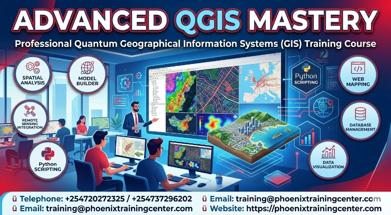
The course is meticulously structured to cover the full spectrum of GIS operations. Participants will explore data acquisition, coordinate reference systems, vector and raster analysis, and the integration of remote sensing data. Emphasis is placed on automation using graphical modelers and the creation of professional-grade cartographic outputs. By the end of the session, attendees will be equipped to handle multidimensional spatial datasets and deliver actionable insights through advanced mapping techniques.
Upon the successful completion of this Advanced QGIS Mastery: Professional Quantum Geographical Information Systems (GIS) Training Course, participants will be able to:
ü Navigate the QGIS interface and customize the workspace for maximum efficiency.
ü Manage and manipulate diverse spatial data formats including shapefiles, GeoJSON, and Raster files.
ü Perform advanced geoprocessing and spatial analysis to support decision-making.
ü Utilize plugins and automated workflows to streamline repetitive GIS tasks.
ü Design and produce high-quality, professional maps for reports and presentations.
Training Methodology
The course is designed to be highly interactive, challenging and stimulating. It will be an instructor led training and will be delivered using a blended learning approach comprising of:
ü Interactive PowerPoint presentations for theoretical grounding
ü Step-by-step software demonstrations
ü Hands-on individual exercises using real-world datasets
ü Group discussions and troubleshooting sessions
ü Practical Session components integrated into every module to ensure skills transfer
Our facilitators are seasoned industry professionals with years of expertise in their chosen fields. All facilitation and course materials will be offered in English.
Who Should Attend?
This Advanced QGIS Mastery: Professional Quantum Geographical Information Systems (GIS) Training Course would be suitable for, but not limited to:
ü GIS Analysts and Technicians
ü Urban and Regional Planners
ü Environmental Consultants and Scientists
ü Data Scientists and Surveyors
ü IT Professionals managing spatial databases
ü Research Officers and Academicians
ü Project Managers in Infrastructure and Logistics
Personal Benefits
Participants will gain a highly sought-after technical skill set in open-source GIS software, increasing their marketability and professional value. The ability to visualize complex data spatially allows for better problem-solving capabilities and the opportunity to lead data-driven projects within their respective fields.
Organizational Benefits
Organizations will benefit from reduced software licensing costs by adopting professional-grade open-source solutions. The training ensures that staff can produce accurate spatial reports in-house, leading to improved resource allocation, better risk management, and enhanced strategic planning through precise geographical insights.
ü Course Duration: 5 Days
ü Training Fee
o Physical Training: USD 1,200
o Online / Virtual Training: USD 800
Module 1: Introduction to QGIS and Spatial Data Fundamentals
ü Overview of Open-Source GIS and the QGIS community
ü Installing QGIS and configuring the user interface
ü Understanding Vector vs. Raster data models
ü Loading data layers and navigating the map canvas
ü Practical Session: Installing essential plugins and setting up a project environment
Module 2: Data Acquisition and Management in QGIS
ü Importing data from CSV, Excel, and GPS files
ü Connecting to WMS, WFS, and Cloud-based data services
ü Digitizing features and creating new shapefiles
ü Attribute table management and field calculations
ü Practical Session: Creating a custom spatial dataset from field survey notes
Module 3: Coordinate Reference Systems and Projections
ü Understanding Geographic vs. Projected Coordinate Systems
ü Setting project CRS and handling "on-the-fly" transformations
ü Identifying and fixing projection errors in datasets
ü Georeferencing scanned maps and aerial imagery
ü Practical Session: Georeferencing an old paper map to match modern vector layers
Module 4: Vector Data Styling and Symbology
ü Applying categorized and graduated symbology
ü Rule-based styling for complex data visualization
ü Labelling techniques and automated placement engines
ü Using the Style Manager and saved symbols
ü Practical Session: Creating a thematic heat map based on population density
Module 5: Advanced Vector Spatial Analysis
ü Buffering, Clipping, and Intersecting datasets
ü Spatial Joins and Data Aggregation
ü Network analysis for routing and accessibility
ü Point pattern analysis and clustering
ü Practical Session: Conducting a site suitability analysis for a new facility
Module 6: Raster Data Processing and Analysis
ü Terrain analysis: Creating Hillshades, Slopes, and Aspects
ü Raster Calculator for environmental modelling
ü Supervised and unsupervised classification basics
ü Extracting values from raster to vector points
ü Practical Session: Generating a Digital Elevation Model (DEM) and contour lines
Module 7: Working with Databases and SQL in QGIS
ü Introduction to the DB Manager
ü Connecting to PostgreSQL/PostGIS and SpatiaLite
ü Writing basic SQL queries to filter spatial data
ü Managing multi-user spatial databases
ü Practical Session: Running a spatial SQL query to extract features within a specific boundary
Module 8: Data Visualization and Map Layout Design
ü Setting up the Print Layout manager
ü Adding legends, scale bars, north arrows, and grids
ü Exporting maps to PDF, PNG, and SVG formats
ü Creating dynamic map atlases for multi-page reports
ü Practical Session: Designing a professional A3 site map for a stakeholder presentation
Module 9: Automation with Graphical Modeler and Plugins
ü Finding and installing third-party plugins (Semi-Automatic Classification, etc.)
ü Introduction to the Processing Toolbox
ü Building automated workflows with the Graphical Modeler
ü Batch processing multiple datasets simultaneously
ü Practical Session: Building a model to automate the clipping and buffering of 50+ files
Module 10: Applied GIS Project and Capstone Exercise
ü Review of advanced spatial workflows
ü Data cleaning and quality assurance checks
ü Integrating external APIs and Python scripts (overview)
ü Final Project presentation and feedback
ü Practical Session: Executing a complete "End-to-End" GIS project from raw data to final map
About Our Trainers
Our trainers are seasoned GIS specialists and data scientists with over 15 years of industry experience across Africa, Europe, and the Middle East. They hold advanced degrees in Geoinformatics and are active contributors to the open-source community. Having implemented GIS solutions for government agencies, NGOs, and private engineering firms, they bring a wealth of practical, "on-the-ground" knowledge to the classroom, ensuring that the training is not just theoretical but deeply rooted in professional application.
Quality Statement
Phoenix Training Center is committed to excellence in professional development. We ensure that our curriculum is updated quarterly to reflect the latest versions of QGIS and emerging industry trends. Our small class sizes allow for personalized attention, ensuring every participant masters the core competencies required for their specific role.
Tailor-Made Courses
We understand that every organization has unique challenges and opportunities as well as unique training needs. Phoenix Training Center offers tailor-made courses designed to address specific requirements and challenges faced by your team or organization. Whether you need a customized curriculum, a specific duration, or on-site delivery, we can adapt our expertise to provide a training solution that perfectly aligns with your objectives. We can customize this Advanced QGIS Mastery Course to focus on your industry, specific risk profile, or internal stakeholder dynamics. Contact us to discuss how we can create a bespoke training program that maximizes value and impact for your team. For further inquiries, please contact us on Tel: +254720272325 / +254737296202 or Email: training@phoenixtrainingcenter.com.
ü Participants should be reasonably proficient in English.
ü Applicants must live up to Phoenix Center for Policy, Research and Training admission criteria.
Terms and Conditions
ü Discounts: Organizations sponsoring Four Participants will have the 5th attend Free
ü What is catered for by the Course Fees: Fees cater for all requirements for the training – Learning materials, Lunches, Teas, Snacks and Certification. All participants will additionally cater for their travel and accommodation expenses, visa application, insurance, and other personal expenses.
ü Certificate Awarded: Participants are awarded Certificates of Participation at the end of the training.
ü Course Improvement: The program content shown here is for guidance purposes only. Our continuous course improvement process may lead to changes in topics and course structure.
ü Approval of Course: Our Programs are NITA Approved. Participating organizations can therefore claim reimbursement on fees paid in accordance with NITA Rules.
Booking for Training
Kindly send an email to the Training Officer on training@phoenixtrainingcenter.com and we will send you a registration form. We advise you to book early to avoid missing a seat to this training. Or call us on +254720272325 / +254737296202
Payment Options
We provide 3 payment options, choose one for your convenience, and kindly make payments at least 5 days before the Training start date to reserve your seat:
ü Groups of 5 People and Above – Cheque Payments to: Phoenix Center for Policy, Research and Training Limited should be paid in advance, 5 days to the training.
ü Invoice: We can send a bill directly to you or your company.
ü Deposit directly into Bank Account (Account details provided upon request)
Cancellation Policy
ü Payment for all courses includes a registration fee, which is non-refundable, and equals 15% of the total sum of the course fee.
ü Participants may cancel attendance 14 days or more prior to the training commencement date.
ü No refunds will be made 14 days or less before the training commencement date. However, participants who are unable to attend may opt to attend a similar training course at a later date or send a substitute participant provided the participation criteria have been met.
Accommodation and Airport Transfer
For physical training attendees, we can assist with recommendations for accommodation near the training venue. Airport pick-up services can also be arranged upon request to ensure a smooth arrival. Please inform us of your travel details in advance if you require these services. For reservations contact the Training Officer on Email: training@phoenixtrainingcenter.com or on Tel: +254720272325 / +254737296202
| Course Dates | Venue | Fees | Enroll |
|---|---|---|---|
| Jul 20 - Jul 24 2026 | Eldoret | $1,200 |
|
| Jul 27 - Jul 31 2026 | Nairobi | $1,200 |
|
| Aug 03 - Aug 07 2026 | Nairobi | $1,200 |
|
| Aug 10 - Aug 14 2026 | Mombasa | $1,200 |
|
| Aug 17 - Aug 21 2026 | Naivasha | $1,200 |
|
| Aug 24 - Aug 28 2026 | Nairobi | $1,200 |
|
| Aug 31 - Sep 04 2026 | Zoom | $800 |
|
Phoenix Training Center
Typically replies in minutes